Home ⟩ Research ⟩ Research Projects ⟩ DroneSOM - Faster mineral exploration with less environmental impacts and costs
DroneSOM – Faster mineral exploration with less environmental impacts and costs
- Project research area
- Geophysical Applications Geoscience Information Solutions
- Project duration
- 01.05.2022 - 31.12.2024
- Website
- https://dronesom.com/
Introduction

The DroneSOM project was initiated in 2022 and is co-funded by EIT Raw Materials. It is led by the Geological Survey of Finland (GTK) in collaboration with RADAI Oy, the Technical University of Denmark (DTU), and Beak Consultants GmbH. The project aims to develop several innovative products to meet the growing demand for battery minerals. Drone geophysics provides cost-effective, accurate, and safe exploration solutions.
The DroneSOM project has developed innovative technologies for geophysical measurement and data interpretation. It includes two drone-based systems: one for electromagnetic measurements and the world’s first operational gravity system on a drone. The project features RADAI’s electromagnetic sensor and a high-precision inertial sensor from DTU for gravity measurements. DroneSOM offers integrated software tools to analyze drone-collected data. GTK’s 3D geophysical inversion software creates 3D models, “GisSOM” combines 2D geophysical data to reveal mineral deposit patterns, and Beak’s “advangeo® 3D Prediction” software integrates volumetric survey datasets.
Drones
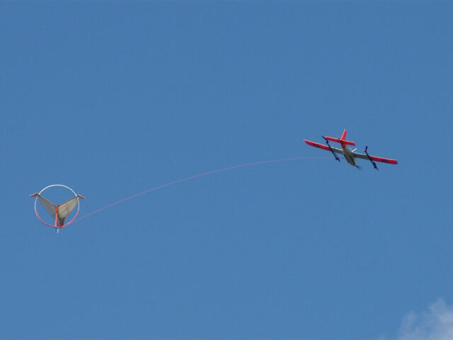
Radai Ltd has created a lightweight electromagnetic drone called Louhi, which consists of an EM receiver unit, and an EM transmitter unit (ground loop). The drone tows the receiver unit, and a large transmitter loop is placed on the ground. The transmitter unit generates an electromagnetic primary field (frequency domain), and the receiver unit (three-component system) measures the sum of the primary and secondary electromagnetic fields. Variations in the measured field components’ amplitude and phase indicate anomalies in soil and bedrock conductivity. Additionally, one-dimensional inversion will provide quick resistivity maps.
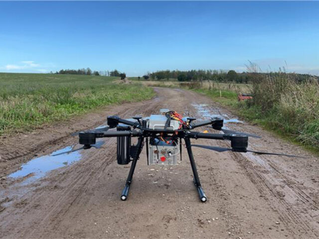
Recent advancements in drone gravity measurements have presented significant opportunities, although flight regulations require drones to have a wingspan under 3 meters and a total weight not exceeding 25 kilograms. DTU Space has developed two types of drones: a fixed-wing drone, suitable for iMAR sensors with an 8 kg payload, and a quadcopter that has faced challenges, including a power issue and engine failure. While the quadcopter’s configuration is nearly optimal, it is not yet commercial-ready.
|
|
|
Software
GTK is advancing 3D frequency-domain electromagnetic inversion techniques for analyzing drone-collected datasets. Quick progress has been made in developing geophysical 3D inversion models, which utilize features like the finite element method, dual octree grid inversion, and MPI parallelization. Future steps include creating an iterative solver, implementing GPU computing, and enhancing electromagnetic inversion methods. These techniques have successfully processed real data, with plans to apply them to drone data in the coming months.
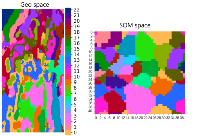
The “GisSOM” software by GTK integrates 2D geospatial data using self-organizing maps (SOM) and k-means clustering, helping users understand data structures, identify clusters, and visualize results related to mineral deposits.
The “advangeo® 3D Prediction” software by Beak Consultants GmbH combines various 3D data sources to identify new exploration targets with high mineral potential in the sub-surface. The software now supports clustering of 3D data using self-organizing maps (SOM). Supervised predictive mapping in 3D had already been implemented into the software using artificial neural networks (ANN) before. The software provides a complete workflow for predictive modeling and includes a database for tracking model runs. It is commercially ready, with ongoing enhancements in development. 3D geological models may be imported into the software from GOCAD or any other commonly used 3D modeling software such as voxets.

The DroneSOM products are designed for the mining industry. Not just focus on state-of-the-art measurements. It includes the interpretation part so that the process, invert, and create models based on drone data, using ML and self-organizing maps. These solutions benefit a wide range of companies, from junior companies to major industry players. The methods of the DroneSOM project are crucial in finding new resources and identifying new targets needed for the future.
Follow us on LinkedIn and dronesom.com
Partners:

Return to projects


