Future Energy and Infrastructure Solutions Are Based on Bedrock Fracturing Data
Bedrock and tunnel construction is an integral part of the societal infrastructure. Because of the green transition, projects aiming for more diverse use of geothermal energy are increasing. In these plans, data about bedrock fracturing, the location and characterisation of fractures and fault systems, and related groundwater in bedrock, play a crucial role. These data are also absolutely vital for the long-term safety of nuclear waste disposal.

The Geological Survey of Finland (GTK) is studying bedrock fracturing in two interconnected projects. The ‘KYT KARIKKO’ project relates to the safety of nuclear waste disposal. It focuses on areas of Southern Finland similar to Olkiluoto in terms of their geological environment. GTK’s own ‘Bedrock Fracturing – Solutions for Customers’ project enables more extensive surveys and a broader range of research outlines.
Studying the Scalability of Brittle Structures in Bedrock
The scalability of brittle structures in bedrock – fractures and faults – is being studied in the KYT KARIKKO project. The scalability of fracture properties and the similarity of findings can be assessed by comparing observations made on different scales. For example, can properties be predicted on a larger scale based on the length and frequency of fractures visible in bedrock outcrops, even if similar large-scale observations are unavailable?
The study focuses on the Loviisa and Ingå regions, as well as the Åland Islands, where Finland’s largest bedrock outcrops are located. These regions offer excellent settings for studying fractures.
Fracture systems are modelled by dividing the distributions of fracture lengths and frequencies into different estimated scales, for which no data are available. “The aim is to reduce the uncertainties that modelling always involves,” says Project Manager Nicklas Nordbäck from GTK.
Using new LiDAR datasets, large structures can be studied based on lineament interpretations – by studying lengthy linear features identified in the topography. Interpretations are made on different scales to identify the scale on which large structures can be studied and the uncertainties involved in scales and datasets. At the same time, how well usable data can be obtained from lineament datasets is identified.
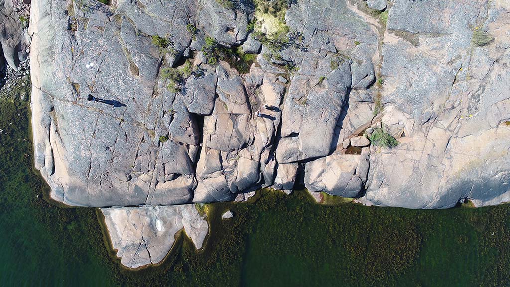
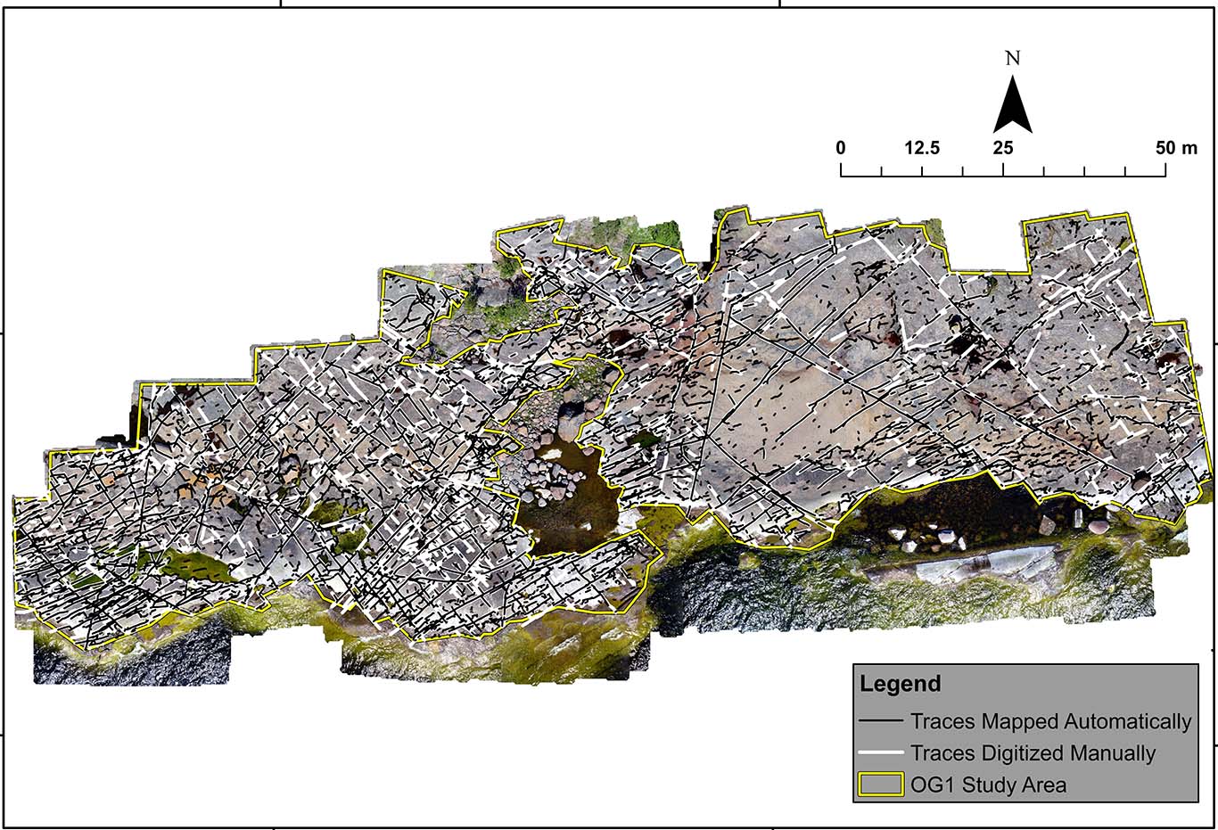
Large datasets have been obtained by mapping large outcrop areas using drones. GIS software has been used to organise image data and produce digital data for analysis. The studies have taught not only how to use drones appropriately, but also their limitations regarding altitude, for example. The researchers have investigated how large the recorded areas need to be for the data to represent the defined bedrock type, and how the areas surrounding bedrock outcrops for which no data are available need to be interpreted.
“We have advanced analysis methods for our fracture maps by developing Python-based codes, for example, to easily separate data and parameters from the datasets,” Nordbäck says.
Coming Up: Lineament Database and Automated Interpretations
A lineament interpretation covering the whole of Finland on the scale of 1:500,000 was conducted in the Bedrock Fracturing project. This scale enables to identify all the large structures that help to determine the locations of more intact bedrock blocks compared to the fractured bedrock. The interpretation was based on topographical LiDAR, geophysics and bathymetry (sea floor) datasets.
The result was a completely new and uniform dataset: the lineament interpretation database. The database will be published in the Geo.fi data service by the end of 2022. A publication which describes how the data have been interpreted will also be released. The database can be used as a source when planning the allocation of further studies in infrastructure construction.
In addition, the automation of lineament and fracture interpretations will be developed to identify fracture traces from images. Automation is needed, as each interpretation is currently made by researchers.
“The code required for automation was obtained from the University of Turku, where researchers are imaging human bones and localising bone fractures. We received the code and started to develop it further based on GTK’s datasets,” explains Project Manager Jon Engström from GTK.
While the code obtains data from images, it cannot yet identify all fractures or obtain sufficient data from low-quality images. Further development is required to use automation in scientific production.

Small Fracture – Large Number of Underlying Factors
The study of bedrock fracturing focuses on the impact of factors affecting the generation and behaviour of bedrock fracturing, including any variation in lithology, i.e. the physical characteristics of rocks. The rapakivi granite area in the Åland Islands was selected for the study, as the isotropic rock helps to better understand the causes of fracturing.
The study compared bedrock fracturing in the Åland Islands and Kopparnäs in Ingå, where the more complex composition and structure of bedrock are reflected in fracturing. Similarities were also found and understanding of the fracture behaviour increased.
Furthermore, understanding of the joint impact of erosion and brittle structures improved during the study. For example, a depression in bedrock nearly always hints at a brittle structure, resulting in valleys and other smaller depressions visible in the terrain. As faults in these depressions impact on stress fields, the directions of fracture sets generated later in the surrounding environment may vary locally. The mechanical heterogeneity of bedrock, including foliation and other weaknesses that have an impact on fracturing, must also be considered.
“We have clearly seen that even small fractures in bedrock outcrops are affected by a large number of factors. A small fracture visible to the naked eye may not tell us much about the underlying system if we do not understand what takes place in the surrounding bedrock,” Engström says.
Deep Bedrock Study and Nuclear Waste Disposal
One of the tasks of GTK’s Site Selection Services team is to study geological factors for nuclear waste disposal. “In Finland, nuclear waste is disposed of in crystalline bedrock. We need to address fracturing, stress and associated faults, groundwater hydrology, and hydrochemistry,” says Taina Karvonen, Team Manager at GTK.
When it comes to nuclear waste disposal, it is essential to localise existing structures and faults. “When selecting the location, we have always looked for bedrock blocks with as little fracturing as possible between existing faults, fracture zones and individual long fractures,” explains Karvonen.
As Finland is located in a tectonically stable shield area, any future movements will be in existing faults and probably very minor. As a result, it is important that disposal canisters are placed in stable bedrock blocks between faults.
The long-term safety of nuclear waste disposal extends from 100,000 to a million years. By studying the past, we can process events over remarkably long periods and predict the future. A bedrock block that has been stable with regard to stress and movements for the last couple of million years will probably be stable for the next million years as well.
In crystalline bedrock, the flow of water is fracture-controlled, which means that fracture networks and links between them must be identified from slightly below the disposal level up to ground surface. At the disposal depth, the groundwater geochemistry must be suitable for disposal and geochemical groundwater conditions as stable as possible to protect canisters against corrosion. This requires knowing the movement of groundwater in the fracture network and understanding the geochemistry of deeper groundwater, as saline groundwater may rise from greater depths over time.
Surface water cannot access the disposal depth when the disposal site is open – over a timespan of roughly 100 years in Finland – or after it has been sealed. Potential changes in conditions, including any future ice ages, and the resulting bedrock depression and meltwater must be taken into account. Flow routes between the disposal depth and ground surface must be examined, and it must be ensured that radionuclides cannot migrate to the surface through the fracture network if there is a canister leak.
“The research methods and results we are developing in the KARIKKO and Bedrock Fracturing projects, can be applied and used on other crystalline bedrock sites. They serve not only nuclear waste disposal, but also construction of infrastructure and geothermal energy projects,” Karvonen says.
Related topics
- All GTK`s online datasets in one place: Geo.fi – home to all geological data >
- A three-part blog series on the application and development of GisSOM software: GisSOM for Clustering Multivariate Data ‒ GisSOM >
